Mon, 7 April 2014
Vertical Climbed: 300 meters (984 feet)
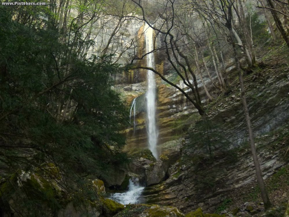
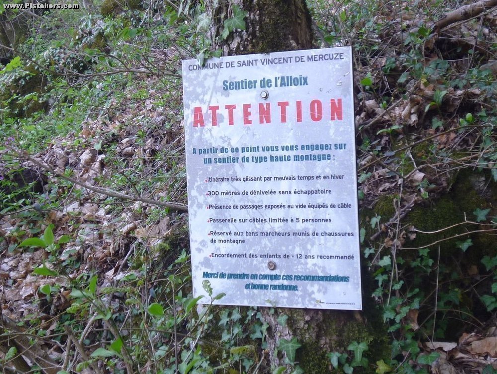
From the carpark climb (yellow markings, signposted Les Chemin d'Autrefois) climb to a hairpin and reservoirs on the Gorge road or descend through Montalieux to climb a path by the side of the Alloix river. The path crosses a series of three waterfalls. After the first (la Gouille Michel) the trail becomes steep and narrow with zig-zags and there are cables but it is not too difficult. At the last waterfall (la Grande Cascade) climb behind the water on a steepish trail, continue another 200m to 690m altitude. Here turn right and follow a jeep trail down to pt. 506 meters (Rogier) cross over the road and return to the car park.
Comments on route: Spectacular series of waterfalls. Ideal in summer when it is too hot elsewhere. Spots for a pic-nic by the first cascade.
Access: A41 to Le Touvet then St Vincent de Mercuze then Montalieu
Equipment: Walking boots
Country: France Area: Chartreuse Trailhead: Montalieu