Ski Areas > Northern Alps > Belledonne > Gleyzin > Pointe de la Comberousse
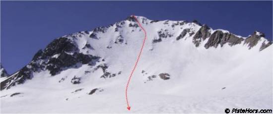
From the car park at the far end of the village climb a track into the Gleyzin valley. At around 1400 meters the path steepens and the Pertuis couloir is on the left (avalanches!), at 1600m the track traverses across some rock bands (avalanches, exposed) to reach a plateau. Climb to the refuge d'Ouel (note that the slope to the right of the refuge is prone to slab avalanches - two deaths in 2004). Climb up the left bank of the bowl, the valley is flatter after the Montagne de l'Oule. Follow the valley eastwards to the glacier du Gleyzin. The Pointe de la Comberousse is directly in front.

| Mountain Range | Belledonne |
|---|---|
| Summit | Pointe de la Comberousse |
| Altitude | 2866m |
| Orientation | North-East |
| Starting Altitude | 1095m |
| Vertical | 1770m |
| Maps | IGN TOP 25 3433 OT Allevard |
| GPS Waypoint | N 45.2989°, E 06.1414° |
| GPS Route | Google-Earth:Gleyzin |
| Grade[1] | Danger: 2, Climb: D, Ski: 4.2 |
| Comments | Direct route from the summit is steep (>45° over 50m), danger of avalanches by the refuge d'Oule |
| Snowboarders | Yes |
| Equipment | ski crampons, ice ax, crampons |
| Road Access | A41 > Goncelin > Allevard -> (le Pleynet/7 Laux) after Pinsot take 1st left to the Bourgeat Noire |
| Refuges | Refuge Antoine Cros? |
| Author | davidof |
A suprisingly good overnight refreeze after Wednesday's soup, better than announced in the avalanche bulletin. I left Gleyzin at 6h30 to arrive at the summit at 11h00. A nice gentle pace. Descent was at 11h30. The snow was very good but maybe just a little early on the west facing slopes which were a bit rough with percolation waves formed by the recent day's heatwave.

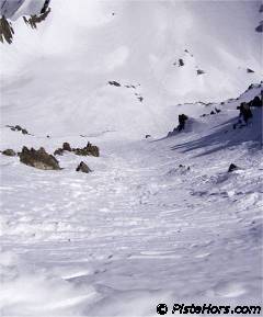
The first 20 meters were very steep with some side slipping by earlier skiers making turns difficult. There was cold, almost powder snow on the right bank of the face in the shade which was better to turn in. Skied down to 1550 meters on the tongue of an avalanche with 35 meters of portage in between. Otherwise the snowline is at 1630 meters.
Category: Trip Reports << Col de Comberousse? | Gleyzin | Tour du Grand Moretan? >>