Ski-Areas > Southern Alps > Briançonnais > Pic De Neige Cordier by the Breche de la Plate Des Agneaux
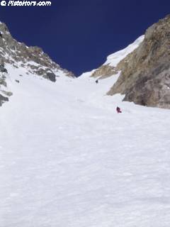
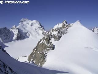
Park at the Pont du Clot du Gué (trail blocked by a forest service (ONF) gate) and follow the summer trail in the direction of the col d'Arsine. In spring you will generally find snow when you exit the forest at 1900 meters. Climb the valley to the Reou d'Arsine then traverse the terminal moraine of the glacier towards the south east. This is a bit complicated. You join a large bowl which gives access to an obvious east facing couloir. At the summit of the couloir (crampons/ice ax) turn left (southwards) to climb the north shoulder which steepens to about 30 meters of mixed climbing to the summit.

The route is also possible from l'Alpe de Villar d'Arêne (2077m). Climb towards the south-east to the Col d'Arsine. At 2320 meters turn directly south and climb a small step to avoid some rock outcrops that join the Pic d'Arsine. Turn west to join the couloir.

It is also possible to climb to the south-west via the glacier du Rif de Planche and traverse to the Breche via a short couloir at point 3038m.
Par le glacier des Agneaux (3.3/E2, passages 35-40°, orientation N) : le glacier est assez crevassé. De plus, les passages rocheux du bas sont souvent vite déneigés. Il mérite d'etre repéré la veille si possible.

It is possible to descend via the Col Emile Pic (famous 19th century Ecrins Guide) after traversing under the north-west slopes of the Cordier. The descent is rated 2.2/E1 with a short passage of 35°+. This lets you stop at the refuge des Ecrins and the glacier Blanc as part of a longer tour.
| Mountain Range | Ecrins |
|---|---|
| Summit | Pic de Neige Cordier |
| Altitude | 3614m |
| Orientation | East/North |
| Starting Altitude | 1568m |
| Vertical | 2046m |
| Maps | IGN 3436 ET Meije-Pelvoux |
| GPS Waypoint | N 44.9559°, E 06.3890° |
| GPS Route | Google-Earth:Casset |
| Grade[1] | Danger: 2, Climb: PD, Ski: 4.2 |
| Comments | (42° over 200m, sections at 45° |
| Snowboarders | The terminal moraine is quite flat |
| Road Access | Grenoble > RN91 > Col du Lauteret > D300L > Le Casset > piste jusqu'au Pont du Clot du Gué |
| Refuges | Refuge de l'Alpe de Villar d'Arêne?, Cabane Pastorale d'Arsine |
| Author | davidof |
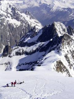
Wonderful weather. We (two skiers and a snowboarder on snow shoes) left the Cabin at the Réou dArsine at 5am. The refreeze was good but we still had trouble climbing the east facing couloir of the Brèche at 8am after a 3 hour crossing of the moraine and there was some stonefall in the couloir. We exited the couloir on the right, a large corniche blocked the left hand side.

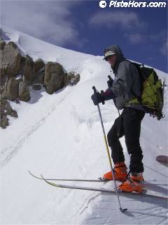
We skied down around 10am after leaving our skis at the top of the shoulder and climbing to the Pic de Neige Cordier on foot. The snow was icy on the shoulder and wet in the couloir and spring snow lower down. It would probably have been prudent to ski down between 9 and 10am. We skied the steeper right bank in the couloir as the snow was harder out of the sun. The snow was skiable to 1700 meters.

Category: Trip Reports
<< | Briançonnais | >>