Sat, 18 March 2006
Minimum altitude: 1,201 meters
Distance: 7.5 km
Slope Aspect: East
Vertical Climbed: 712 meters (2,336 feet)
Vertical Descended: 710 meters
Rating: 4.1
Avalanche Risk: 2
Snowline: 1,060
Nice couloir, never too steep. The area has generally good snowfall. Views of the Oisans, Mont Blanc and Vercors mountains.
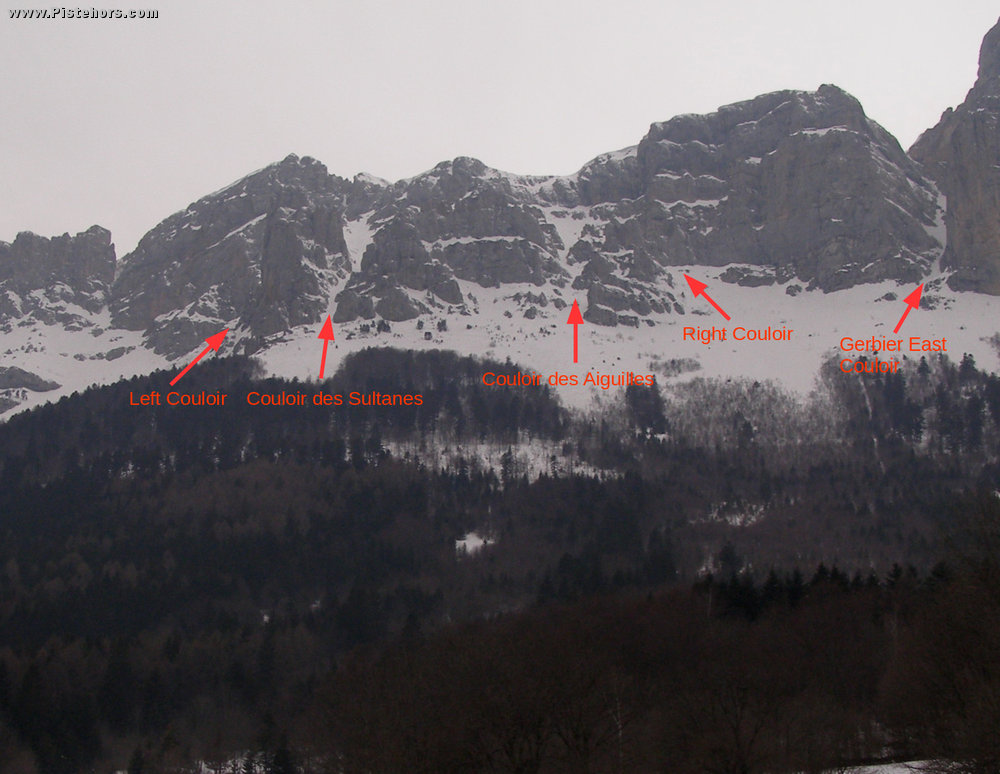
Climb the forest trail to the car park at 1306 m (at the end of the season you can do this in a car). Continue another 300 meters. You come to a hairpin, continue another 300 meters on the trail to the right. Just before sign board climb the forest to arrive directly unde rthe Sultanes couloir (pas de l'Oeille - an Oeille is a rock finger and this is the Sultane). Climb the couloir (direction NW) the top of the couloir is frequently blocked by an impressive cornice.
Variants
Right NE couloir. Via the Bordeaux trail you climb above les Aiguilles. Ends on a ridge just before the Sultanes couloir. The Sultances can be reached by crossing a very steep bowl (think about using crampons and doing this on foot).
Left SE couloir. Follows the summer path. It joins the Sultanes just below the summit. It is skiable, exposed at the top and follows a "couloir" through the forest to join a forest trail below les Clos. You have to climb this to reach the car park)
Couloir des Aiguilles. Direction under pt 1960m on the IGN map this couloir winds down between the Aiguilles mountain.
Start : Prélenfrey (990 m), Vercors, France
Road Access: From Grenoble
follow the autoroute to Sisteron. Take junction 12 for Vif. Cross Vif
and take the road D8 towards le Gua in Prélenfrey take a road to the
right that ends in a ski de fond trail.
Trip Report
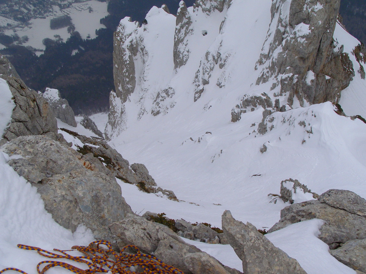
Tour of the Right, Aiguilles and Sutanes couloirs. We climbed by the right couloir and joined the Sultanes after an airy and exposed scramble. After some icy climbing by Ben we managed, all seven of us, to scramble onto the summit plateau via an impressive cornice. The descent was in powder then transformed snow above the forest. Some crust in the trees not always easy to ski.
Snow and zero visibility. Not cold, not warm.